Southwest Trip
In October, while Martha was in Europe, I decided to do a photo roadtrip to capture fall colors and explore southern Utah. I was gone just over two weeks and had a FANTASTIC trip:
- 2 days backpacking in Big Indian Gorge on Oregon's Steens Mountain to photograph aspens -- aspens were great, but snowed on me for two days ... got me ready to appreciate a couple of weeks in the warm Southwest. I also visited the famous Pete French Round Barn in this area.
- 2 day drive to S. Utah, thru middle of Nevada. I stopped to explore Great Basin Nat'l Park in eastern Nevada and I took a great 2 mile "break from driving" hike in aspens and 5" snow (but weather great). I found it a surprisingly nice, small alpine area (its Mt. Wheeler is 13,000 feet high).
- 2 days hiking some southern Escalante/northern Vermillon Cliffs Nat'l Monument areas on the Utah/Arizona border. I really lucked out and got one of the very rare permits to hike into The Wave, with its fantastic sandstone formations. Only 20 people a day are allowed into this area, with 10 slots held aside for a daily lottery. On the day I was there, about 100 of us were vying for those 10 spots, and my name was drawn for the last slot! So, I spent a whole day exploring the Wave area (aka Northern Coyote Buttes). I got out on the 3 mile trail with a headlamp before dawn and had the place to myself until late morning. That afternoon I met another photographer who knew the area well and invited me to see two other less well-known, wonderful spots. The first was an incredible wind sculpted "alcove" at the top of the cliff behind The Wave (i.e., the Top Rock area). And the second was a smaller alcove with a "window" in its wall through which you see a framed distant "Tepee" sandstone formations. Better yet, on that alcove's opposite side is a small arch, through which you can see the window, through which you can see the "Tepees" ... wow!
- The other day in this area I hiked some of Buckskin Gulch – a 14 mile long slot canyon,10-15' wide with 75-150' vertical walls of red Navajo sandstone. It had recently rained, so I was walking in calf deep, very cold water much of the time.
- 1 day hiking into two small slot canyons in NW Escalante Nat'l Monument, below Bryce Nat'l Park (Willis Creek & Lick Wash).
- 4 day backpack in Coyote Gulch in the northern Escalante, a spot that Mark and I backpacked into 2+ years ago. It's a tough 5 mile hike in, down a dry, dusty creek bed. But then you reach a lush, Cottonwood tree-filled, deep sandstone canyon (aka Gulch) with a good size stream. In fact, you mostly walk in the stream as you can explore the Gulch's downstream 10-ish miles before it runs into Lake Powell. Those miles are filled with arches, waterfalls, cascades, and huge, beautiful surrounding Navajo sandstone walls. I only came out when I ran out of camera power.
- 1+ day "jeep trip" on backroads in Capitol Reef Nat'l Park to some fantastic areas (e.g., Upper and Lower Cathedral canyons). Driving to Capitol Reef took me on Utah route 12 through Boulder Mountain and the largest aspen forest I have seen (it had only a little color left).
- 1 day in Monument Valley, 'til I got sick of the blowing fine, fine sand everywhere.
- 1 day in Zion Nat'l Park -- I wanted to get another, higher resolution, digital shot of the "Tree in the Echo Canyon" picture I took on film in November 2000. I was hoping that the tree would be showing some fall color, as it had been about two calendar weeks later in 2000. But, after a late afternoon sprint up Echo Canyon, rather than finding a yellow vs. green tree, I found no tree ... it was gone. It looked like it was wiped out in a flood this past summer, with only a stump left :>( ... It was a very "zen" moment for me.
- 2 day drive home with some nice fall color found around Lakeview and the North Klamath River in Oregon.
A theme of permanence vs. change seemed to pervade this trip for me -- here I was hiking through areas that took millions of years to form, with the macro features changing imperceptibly slowly. But on the micro scale, I saw more year to year change than anywhere else I have ever hiked -- the canyons see frequent huge flash floods that wipe out trees, move tens-of-feet-thick sand & rock from one canyon side to another, wedge tree-sized logs 25 feet up a 100 foot deep slot canyon, and deposit or remove car-sized boulders in canyon bottoms.
I celebrated the 4 month anniversary of my new hip while on this trip ... I am very pleased on how well it held up with all the hiking, and even backpacking.
Some of my favorite photos from the trip can be viewed in the galleries below:
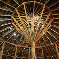
Pete French Barn
Rick Samco's 2007 photos from Pete French Barn, Oregon
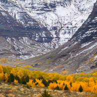
Steens Mountain
Rick Samco's 2007 photos from Steens Mountain, Oregon
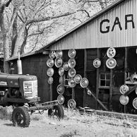
Central Nevada
Rick Samco's 2007 photos from Central Nevada
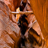
Buckskin Slot Canyon
Rick Samco's 2007 photos from Buckskin Slot Canyon, Utah
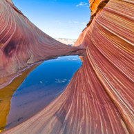
The Wave
Rick Samco's 2007 photos from The Wave, North Coyote Buttes, Arizona
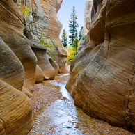
Willis and Lick Slot Canyons
Rick Samco's 2007 photos from Willis and Lick Slot Canyons, Utah
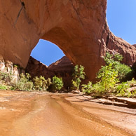
Coyote Gulch
Rick Samco's 2007 photos from Coyote Gulch, Escalante National Monument, Utah
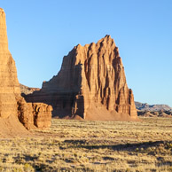
Capitol Reef National Park
Rick Samco's 2007 photos from Capitol Reef National Park, Utah
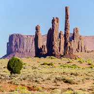
Monument Valley
Rick Samco's 2007 photos from Monument Valley, Arizona
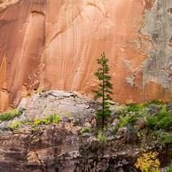
Zion National Park
Rick Samco's 2007 photos from Zion National Park, Utah
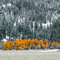
North Klamath River
Rick Samco's 2007 photos from North Klamath River, Oregon
