
La Paz & Lake Titicaca
La Paz sits at 12,000 feet in a canyon surrounded by the Andes and the high Altipano plateau. The steep walled canyon is completely filled by its million inhabitants and a byzantine network of roads. A network of gondola lifts has recently been constructed for transportation across the city and to neighboring El Alto. El Alto is an even larger city built on the surrounding plateau above the canyon, and is where many of La Paz's workers leave.
Lake Titicaca also sits at 12,000 feet, surrounded by high Andrean peaks, and is the largest lake in South America. It was a center of pre-Inca and Inca cultures, with vast agriculturall terraces served by a sophisticated irrigation network. We spent two days on its Isla del Sol, exploring its Inca ruins, including Challapampa where the Inca Sun God came to earth.
Panoramas – Tap/click on a pano's thumbnail to show an interactive, moving panorama; use the on-screen control bar or your finger/mouse to move around:
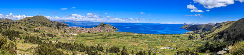
Copacabana on Lake Titicaca:
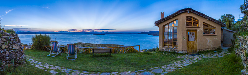
Cordillera Real, Isla de la Luna, & Lake Titicaca from EcoLodge, Isla del Sol:
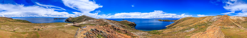
Challapampa Ruins, Isla del Sol:
Hiking back from Challapampa Ruins, Isla del Sol:
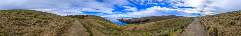
Image Gallery – Tap to view an individual image, then swipe to advance; use the top-right controls for auto play & other options (e.g, tap the curved arrow to open sharing options):


